DeepNL DICTUM
DeepNL DICTUM (2022 -)
DICTUM: Deep, deeper, deepestNL – Imaging the Dutch crust and upper mantle using multi-geo-observables is a project funded within the DeepNL research programme of NWO.
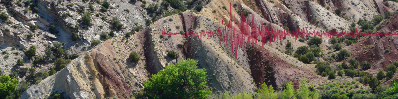
The ambition of safely utilizing the deep Dutch subsurface for current and future investment, like the emerging ultra-deep geothermal projects, requires good insight into the conditions in the Earth at these depths. At this moment this information is not available, and the aim is to create new crust and upper mantle models of the Netherlands with unprecedented resolution. The models will be of multi-physics nature, including seismic velocities, density, and temperature. The new models will serve as a crucial layer of information for decision-makers regarding locating resources and risk assessment.
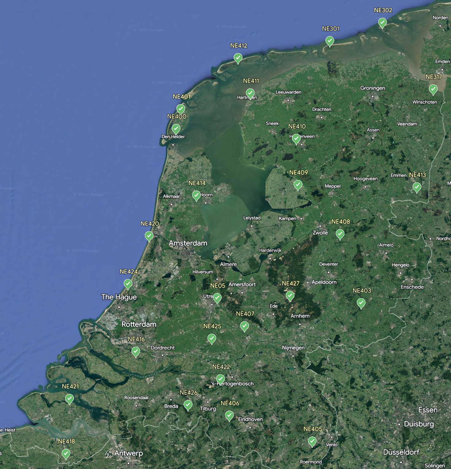
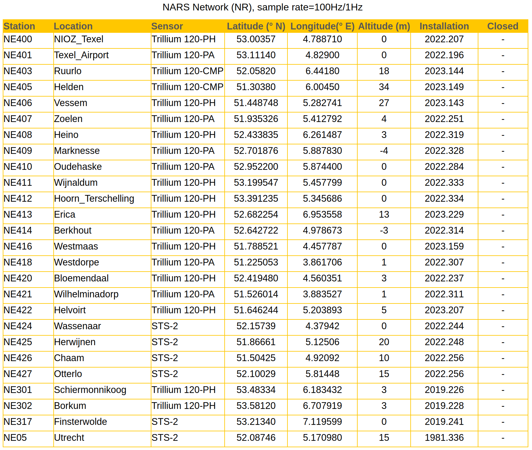
Station list & Data
Equipment
A large part of the seismic equipment used in this DICTUM project is the same as that used in the DEEPNL Groningen project. Additional equipment was borrowed from the Institut für Geophysik, University of Münster: Taurus data loggers from Nanometrics with either a Tillium120PA sensor or a Trillium120 compact sensor.
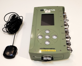
Taurus datalogger
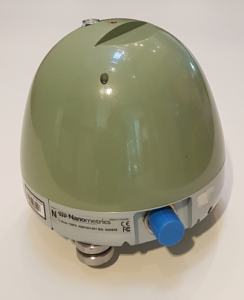
Trillium120PA
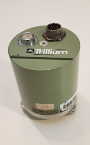
Trillium120 compact
Site preparation
Site construction with Trillium120 PA and Trillium compact seismometer
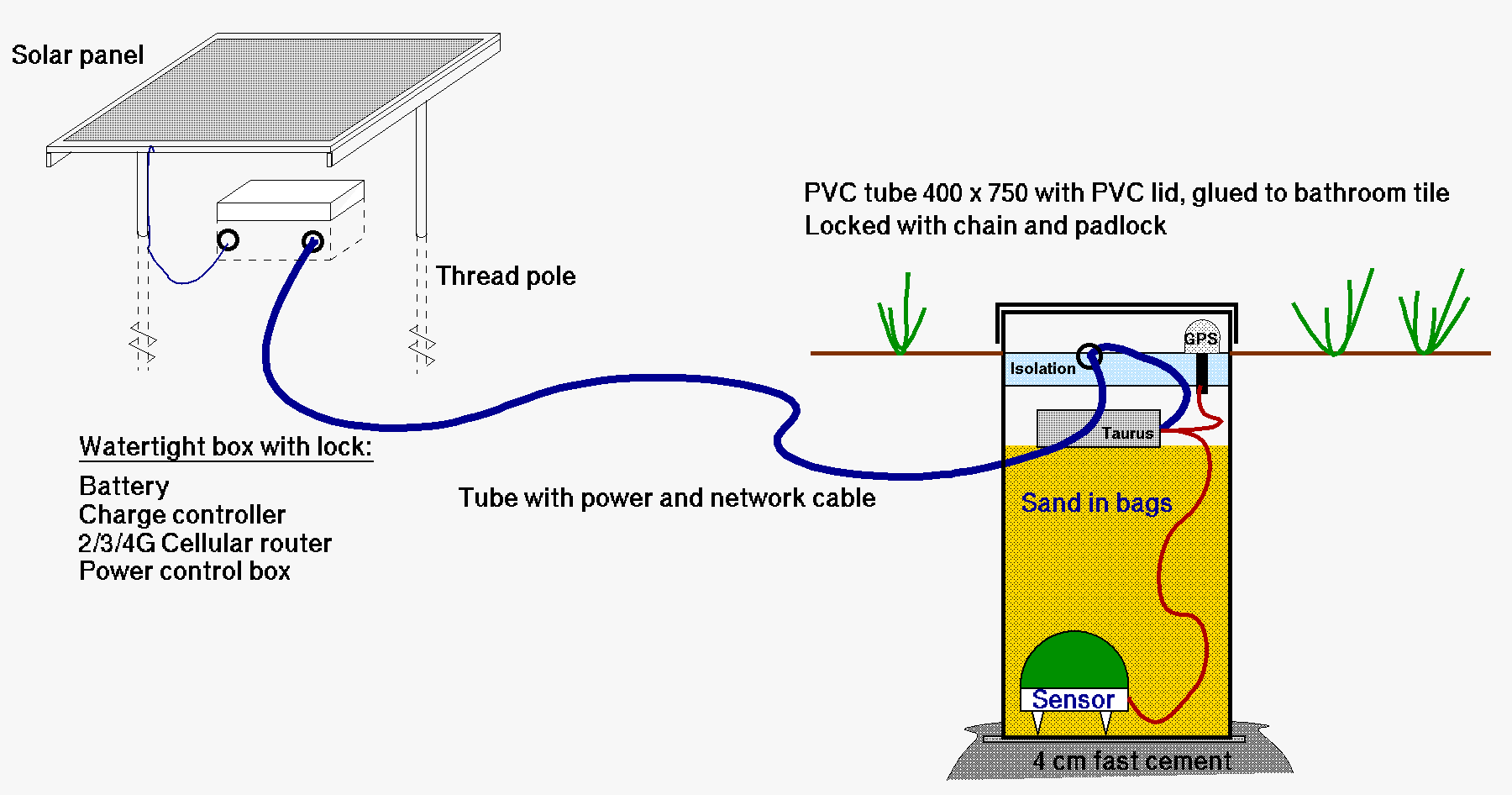
Both types of sensors are leveled by means of 3 legs and therefore need to be positioned on hard underground. This is difficult for an installation in the Dutch soil that usually consists of clay, sand or peat, often with high groundwater level.
 In order to be able to use this type of sensor, a PVC tube is glued to a waterproof bathroom tile. The tile is placed on a bed of rapid cement in the ground. Because the adjustable feet of the sensor must remain within arm length reach, the tube has a maximum length of 75 cm. The sensor is placed in the tube on the tile. After adjustment, it is covered with plastic bags of dry sand until the tube is 3/4 full. On top of this comes the data logger with GPS antenna. The tube is closed with a PVC lid and secured by a padlock chain. The plastic cover gives no signal loss for the GPS antenna.
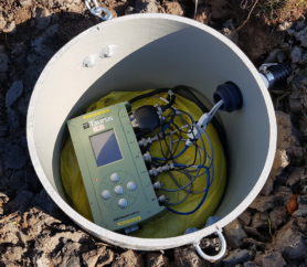 Due to the weight of the sand and the fact that the tile protrudes, the pipe cannot be pushed upwards by the groundwater. The necessary cables run to the data logger through a flexible hose.
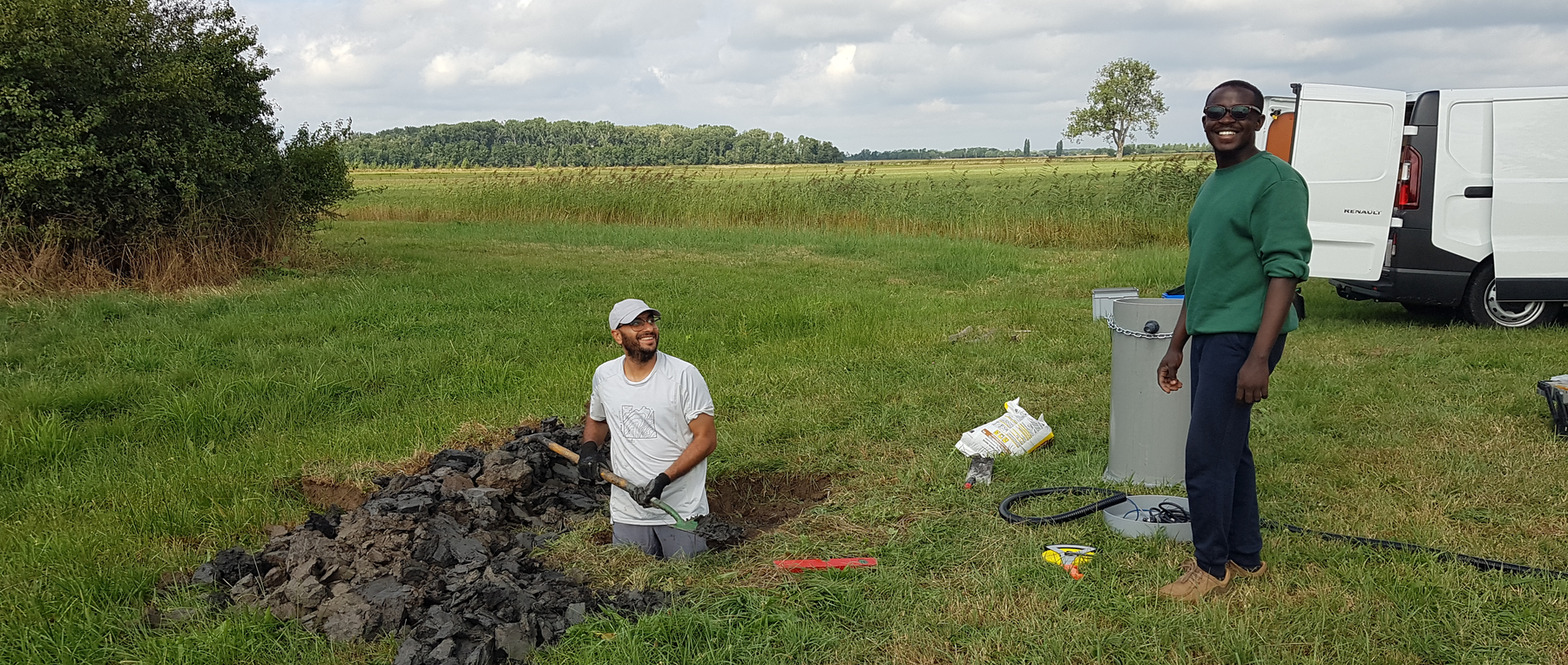
Hard work in fat clay! Islam Fadel & Stephen Akinremi
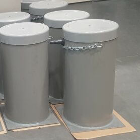
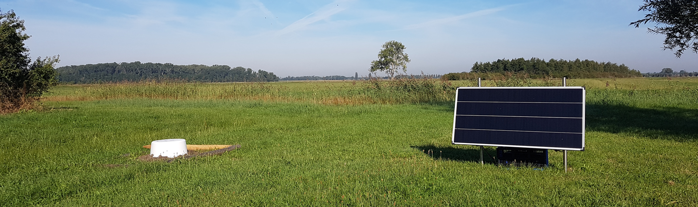 For extra visibility a white plastic barrel is placed over the tube.